post

Monoliths, Mountains and Mighty Canyons.

Uluru stands 350 metres above ground and sits up to six miles below. It is spectacular, but on this continent of extreme nature it is not alone in its grandeur, scale and drama.


Light and shadow is cast by the passing clouds

Light and shadow is cast by the passing clouds

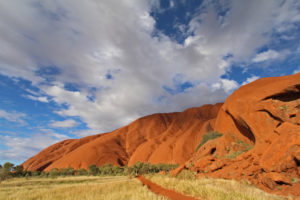
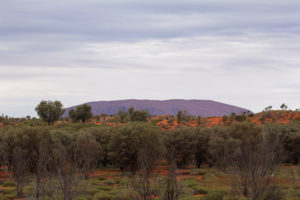
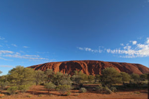
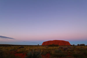
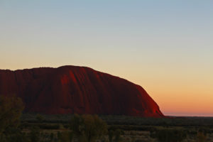
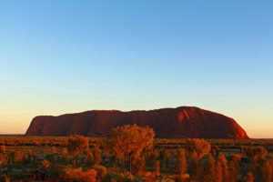
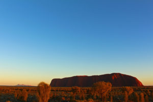
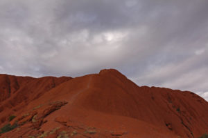
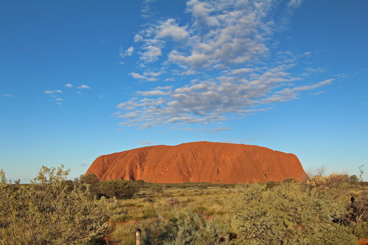
Formally known as Ayers Rock, Uluru is, to get technical, an inselberg. To be more evocative, that translates literally to – an island mountain. Long before you see it in its entirety, it dominates the skyline.

Looming on the horizon

Looming on the horizon


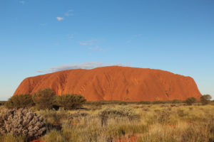
The rock

The rock


Even the wide angle lens doesn't do justice to the scale of Uluru

Even the wide angle lens doesn’t do justice to the scale of Uluru


It is nearly 9.5km in circumference. A mammoth sandstone rock in the middle of the desert, it is considered sacred by the Aboriginal people of the area and has captured the imagination of the millions of visitors who have come to gaze on its vastness over the years.

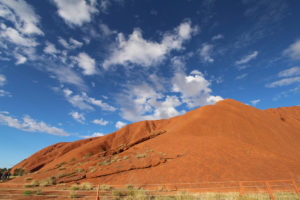
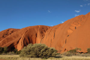
One of the many faces of Uluru

One of the many faces of Uluru


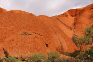
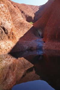
The black streaks and dimples become waterfalls and wells during the rains

The black streaks and dimples become waterfalls and wells during the rains


The colours are every changing with the sun and the clouds

The colours are every changing with the sun and the clouds

There are many differing Aboriginal stories of how the rock came to be, but regardless of which version, it is now one of the most recognisable nature wonders of Australia. It is famed for it ever-changing glorious red and golds as the sun drifts up, over and down its surprisingly smooth faces.

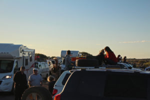
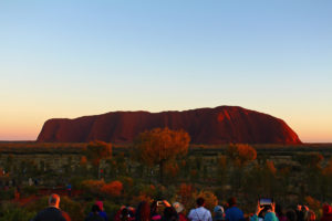
Watching the sunset at Uluru is one of the must do events of a visit. With the solid constant presence of the rock beyond the trees, the crowds swell and jostle for prime photo positions.

The crowds gather for sunset

The crowds gather for sunset

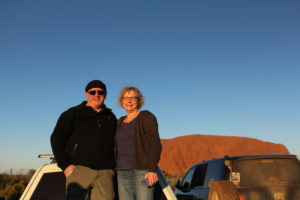
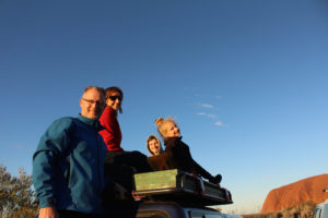
We were fortunate enough to spend the time with old friends. Mick and Rusty were at the Army Apprentice School with Geoff back in the day. We tagged along with Mick, his wife Sue and kids Jack and Georgia (aka Buzzard and Possum) and Rusty and Marg for a week of their holiday. Thanks for letting us gate-crash the party guys!

Rusty and Marg Playford

Rusty and Marg Playford


Mick, Sue, Jack and Georgia Poxon

Mick, Sue, Jack and Georgia Poxon


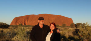
Us at Uluru at sunset

Us at Uluru at sunset

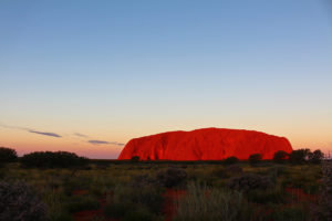
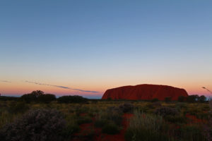
And then come the colours.

The red rock glows with fire as the sun dips

The red rock glows with fire as the sun dips


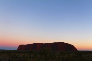
A pinky blue backdrop to the sunset

A pinky blue backdrop to the sunset


How many photos can you take of a rock at sunset? A lot!

How many photos can you take of a rock at sunset? A lot!


As the rock colour fades, the sky lights up

As the rock colour fades, the sky lights up


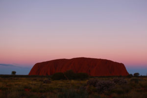
Sunrise is just as popular. Around on the opposite face early the next morning the coffee and cameras were at the ready.

Colours of morning

Colours of morning


Everyone is ready to greet and photograph the dawn

Everyone is ready to greet and photograph the dawn


The first morning blush in the sky and on the end of Uluru

The first morning blush in the sky and on the end of Uluru


Even the trees take on the morning glow

Even the trees take on the morning glow


Sunrise over the rock, with the Olgas in the distance

Sunrise over the rock, with the Olgas in the distance

The colours are perhaps not as dramatic and the night before, but that great rock still manages to capture your breath, and make you feel that magic is about to happen.

Uluru/Ayres Rock has not always been a happy place. There was the famous case of Lindy Chamberlain who fought a long court case to prove that a dingo and not she had killed her baby at the Rock.

For many years the local Aboriginal community claimed they were the traditional owners of the land and Uluru was theirs fought to be recognised as the rightful guardians of the area, and in 1985 the rock and the surrounding lands were finally handed back to them.

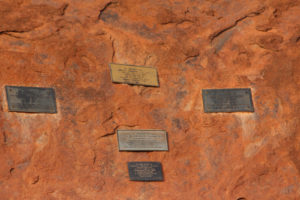
Thirty five people have died trying the climb the rock.

Testimony to some of those who have died climbing the rock

Testimony to some of those who have died climbing the rock

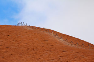
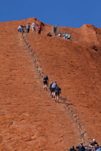
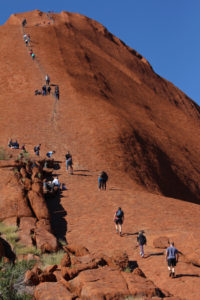
No photo can do justice to the difficulty of the climb and the steepness of the smooth rock face. A chain has been put in place for many years to help those who take up the challenge.

The climb to the top is a lot harder than it looks

The climb to the top is a lot harder than it looks


The climb is so steep that you need to pull yourself up on the chain

The climb is so steep that you need to pull yourself up on the chain

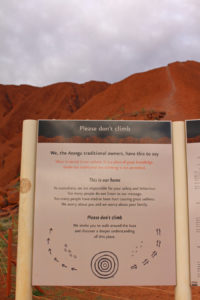
The Anangu Aboriginal people of the area, for whom the rock is sacred, request visitors not to make the climb and often nature puts a stop to it anyway, with high winds or low clouds making it even more dangerous and the chain is closed.

The request from the traditional owners not to climb, in front of the chain for the climbers

The request from the traditional owners not to climb, in front of the chain for the climbers

But many still do and the views from the top are reportedly spectacular.

Walk the line

Walk the line


As soon as the climb is open, people climb

As soon as the climb is open, people climb

The views from the base are pretty amazing. A 10km walk all around the rock shows the different faces and sacred places of Uluru. We thought we might ride it on hire bikes, but at $45 each, we decided a leisurely stroll was more our style!

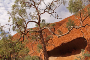
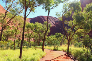
Even the trees look ancient

Even the trees look ancient


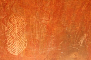
Aboriginal stories and information feature all around Uluru

Aboriginal stories and information feature all around Uluru


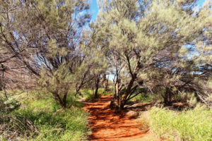
The walk around the base of Uluru

The walk around the base of Uluru


The waterhole

The waterhole


The walk to the waterhole

The walk to the waterhole


From waterholes to surprising amounts of lush vegetation, and the more than twenty different species of animal that live and thrive on this lifeless looking rock, it is truly a special place worthy of its World Heritage Site status.

But it is not alone. Not far from Uluru is Kata Tjuta or the Olgas. A group of sandstone mountains even higher than Uluru and also part of the sacred dreaming and meeting places of the local Aboriginal people.

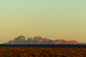
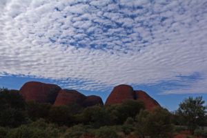
Kata Tjuta, the Olgas in the early morning haze

Kata Tjuta, the Olgas in the early morning haze


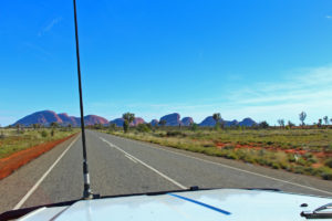
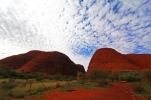
Kata Tjuta or the Olgas are also spectacular and hardly get a mention outside Australia

Kata Tjuta or the Olgas are also spectacular and hardly get a mention outside Australia


The highest point of Kata Tjuta is more than 200m higher than Uluru

The highest point of Kata Tjuta is more than 200m higher than Uluru

There are 36 domes in all, spread over nearly 22 km2 and while Uluru gets all the attention normally, the highest of the three dozen, Mount Olg – at 1,066m – towers over the Rock.

Like Uluru, there are many Aboriginal legends around the creation of the domes, but many are not told to outsiders, especially women, as much of the site is considered “men’s business.

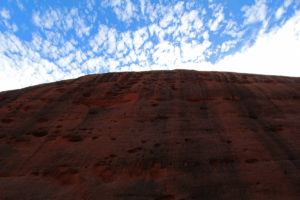
Looking up on of the sheer walls of Kata Tjuta

Looking up on of the sheer walls of Kata Tjuta


 Mount Olga

Mount Olga


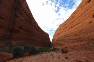
Walking through one of the gorges at the Olgas

Walking through one of the gorges at the Olgas


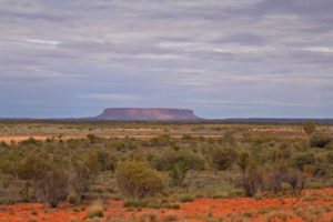
South of the Uluru / Kata Tjuta national park is another monster monolith – Mount Conner. With such illustrious near neighbours Mount Conner doesn’t get much press, and if you are coming up from the South it is often for people the first tantalising and incorrect glimpse of Uluru. But Mount Conner is pretty impressive in its own right, so we wanted to give him some space amongst the big ones.

Mount Conner

Mount Conner

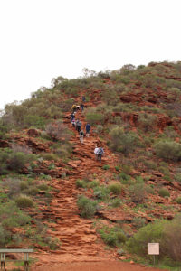
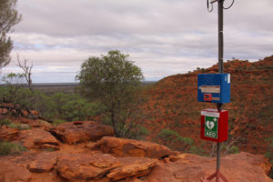
Uluru and the Olgas may get the “being the biggest prize”, but Kings Canyon not only has size and scale, it also has a hike that boasts a 100m climb affectionately known as Heart Attack Hill, before you reach the rim. Once up there you are greeting with a reassuring defibrillator and emergency radio beacon!

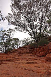
The beginning of the climb up Heart Attack Hill

The beginning of the climb up Heart Attack Hill


Heading up Heart Attack Hill

Heading up Heart Attack Hill


Just in case Heart Attack Hill lives up to its name

Just in case Heart Attack Hill lives up to its name


There's still a long way to go

There’s still a long way to go


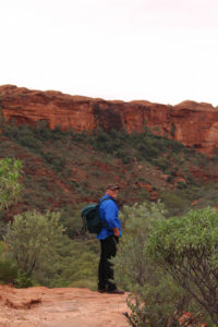
Thankfully we didn’t need the machine, and the five hundred roughly hewn steps we had toiled up lead us onto the top of the canyon and a six kilometre walk, scramble, hike over ancient stones and a landscape that has remained unchanged for millennia.

Just for scale - the tiny white dot in the centre is a person!

Just for scale – the tiny white dot in the centre is a person!


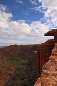
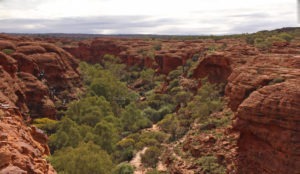
Vast vistas

Vast vistas


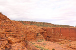
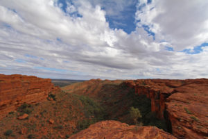
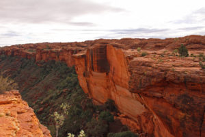
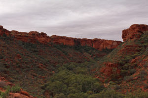
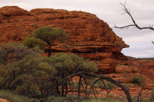
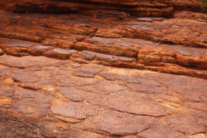
The cliff faces of the canyon are weathered over endless time. Some have had more recent rock falls, which have left spectacular slides behind.

Remnants of the last wall slide

Remnants of the last wall slide


Dramatic landscapes

Dramatic landscapes


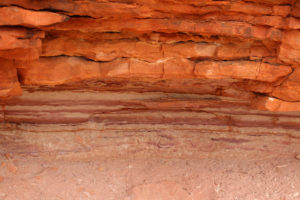
Layers of time

Layers of time


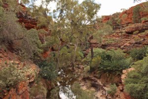
Kings Canyon is an important watering hole in the harsh Red Centre of Australia. Little wonder that the waterhole and towering trees at the base of the gorge is called the Garden of Eden.

The Garden of Eden on the valley floor

The Garden of Eden on the valley floor

More than six hundred species of animals and plants live in the Canyon, taking shelter in the vast gorge and enjoying the Garden.

Looking toward the Garden of Eden, with the black outline of the steps across the gorge

Looking toward the Garden of Eden, with the black outline of the steps across the gorge


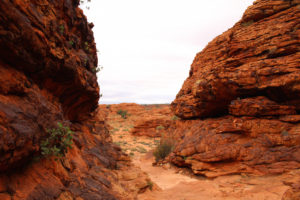
Looking along the curve of Kings Canyon

Looking along the curve of Kings Canyon


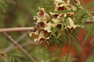
Flowers and berries feed the many birds and animals that live in Kings canyon

Flowers and berries feed the many birds and animals that live in Kings canyon


Bowed and ancient

Bowed and ancient


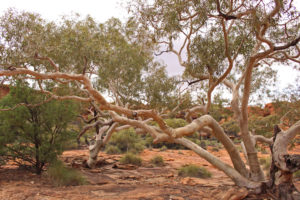
Kings Canyon is a key water source in the area and the River Gums know it

Kings Canyon is a key water source in the area and the River Gums know it


Nature will always find a way to flourish

Nature will always find a way to flourish


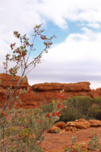
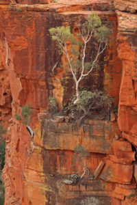
It is surprising how much grows on what seems like barren rock

It is surprising how much grows on what seems like barren rock


The Lost City is another area of the Canyon Rim – with towering walls and stunning natural formations, including solid rock, still rippling with the traces long-forgotten streams.

Where the river once ran through it

Where the river once ran through it


The climb opens out into a natural amphitheatre

The climb opens out into a natural amphitheatre


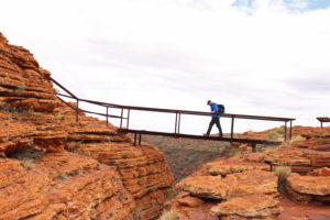
More recently tourism has brought a boom to the area. Cotterill’s Look Out is named after one of the Red Centre’s early pioneers of tourism to the region – Jack Cotterill.

Crossing the bridge to Cotterill's lookout

Crossing the bridge to Cotterill’s lookout


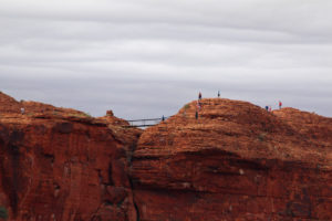
Looking across to Cotterill's Look Out

Looking across to Cotterill’s Look Out


While Uluru and Kata Tjuta and Kings Canyon may be a relatively new find for tourists, local Aboriginal people have lived and thrived in each place for more than 20,000 years and they rugged rocks, canyons and mountains are still important sacred areas for them. After visiting all three it is easy to see why.

post

Outback Tracks

Modern technology has given us electric cars and rockets to Mars, but you still can’t beat driving a classic old outback track across Australia, in a quarter century old 4WD!

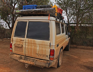
Our mud-encrusted workhorse

Our mud-encrusted workhorse

The outback tracks in Australia were predominantly stock routes – some were more “official” than others

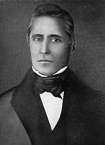
Having finally made it across from the east coast on The Big Detour, out first Aussie outback track was, strangely named after a Polish explorer. But what an explorer! Pawel Strzelecki was about as different from Australia’s famously failed adventurers Burke and Wills as you could get.

Paweł Edmund Strzelecki

Paweł Edmund Strzelecki

Born of noble stock in Poland he became a notable explorer, navigating his way around North and South America, Europe, Africa, Cuba and many south Pacific islands before arriving in Australia in 1839.

While in Australia he explored and surveyed vast areas of Gippsland and the Snowy Mountains – climbing and naming Australia’s highest Mount Kosciuszko in honour of a national hero in Poland. He mapped Tasmania, mainly travelling on foot and in all covered 11,000 kilometers of New South Wales, Victoria and Tasmania. He eventually left for England via China, the East Indies and Egypt and on arrival was recognized by the Royal Geographical Society.

Strzelecki did much good work in his life, including coordinating famine relief in Ireland and was given many awards. It is not only the Track that bears his name in Australia, but also a desert, a mountain range, a mountain, a peak, a creek and a highway.

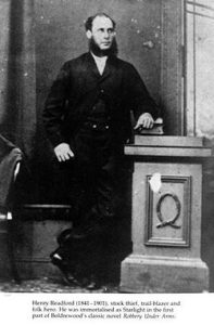
It is ironic that the Track which is named after such an upstanding man was actually mapped out by a thieving bushranger.

Harry Redford looked quite respectable in this photo

Harry Redford looked quite respectable in this photo

Harry Redford was working a cattle station in Queensland which was so large that he realized the owners wouldn’t even notice if some of their cattle went “missing”. Over a three month period in 1870 he corralled and then drove 1,000 cattle through some of the harshest outback lands, including carving a track through the Strzelecki Desert. His 1,000kilometer journey was so impressive and audacious that when he was finally caught, the jury acquitted him.

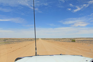
Thankfully we didn’t have any cattle to herd and these days on a good day the Strzelecki Track could be driven at 100kmph in a Toyota Camry.

Straight, true and blue - the Strzelecki stretches out before us

Straight, true and blue – the Strzelecki stretches out before us

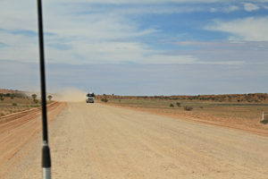
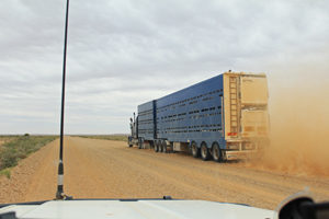
Even the road trains steam through – leaving their mark on everything they pass!

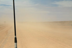
Now you can see me

Now you can see me


Now you don't

Now you don’t

But on a bad day it can’t be driven at all. We had a good day to start with, but spotted a few signs of what it can be like on a bad one.

Showing it's stock route roots

Showing it’s stock route roots

And then we found out how little it takes for it to be a bad one.

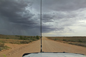
Here comes the rain again

Here comes the rain again


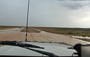
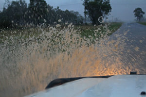
Just a light shower and we are skidding through heavy clay

Just a light shower and we are skidding through heavy clay

Just a spit of rain turned the baked earth into sloppy, cloying mud. Much more rain and we would not have made it through.

But like Strzelecki and Redford, we finally got to the other end, sliding into Marree, mud-coated and ready for our next classic track.

After the rain and a long way from a car wash

After the rain and a long way from a car wash


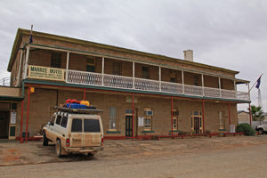
Fresh from the Strzelecki Track we make ready at Marree to head up the Oodnadatta Track

Fresh from the Strzelecki Track we make ready at Marree to head up the Oodnadatta Track

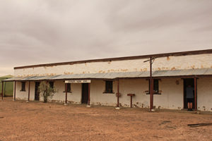
Marree is the start of the Oodnadatta Track – an historic outback town that is proud of its history.

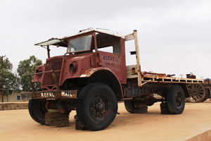
It might not look like much now, but the Marree mail truck always got through

It might not look like much now, but the Marree mail truck always got through


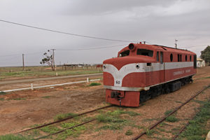
Memories of another age when the great Ghan still ran from Marree

Memories of another age when the great Ghan still ran from Marree

The Oodnadatta Track from Marree to Marla is another Australian touring legend. Named after a small town along its stretch, the track is a dirt road running more than 600km to the centre of Australia. It follows ancient Aboriginal ochre trading routes and it is easy to see why.
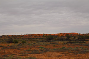
The Red Hills of the Oodnadatta Track

The Red Hills of the Oodnadatta Track


Lake Eyre South - where Donald Campbell secured the world land speed record

Lake Eyre South – where Donald Campbell secured the world land speed record

Much of the track runs parallel to Lake Eyre, which you can read and see more of in our previous blog “ Lake Eyre from the Air”.

As well as the wonders of the Lake, the semi desert track holds many surprises.

You start to see strange things when you have been on the track for awhile

You start to see strange things when you have been on the track for awhile

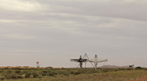
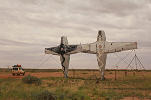
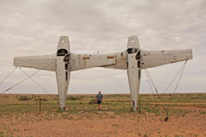
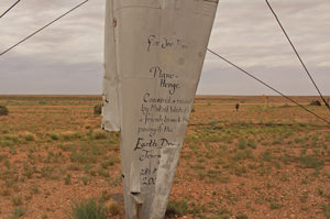
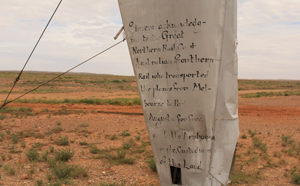
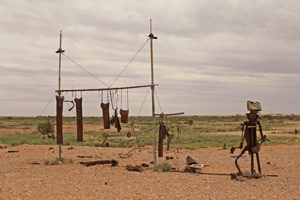
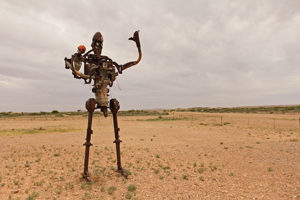
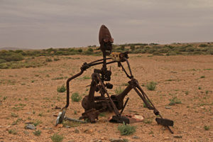
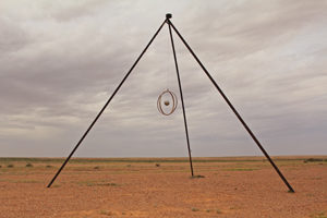
Plane Henge is a sculpture park 70 kilometers into the desert with planes, parts of trains and automobiles fashioned into glorious quirkiness.

The planes draw you into the bizarre scultpure park

The planes draw you into the bizarre sculpture park


Am I really standing between two planes on their tails in the middle of a desert

Am I really standing between two planes on their tails in the middle of a desert


With thanks to the Mutoid Waste Company

With thanks to the Mutoid Waste Company


Good to know the railways still had a sense of humour too

Good to know the railways still had a sense of humour too


Laundry day is hardcore in the outback

Laundry day is hardcore in the outback


We loved this proud dad taking a self with his orange-hatted kid on his shoulder

We loved this proud dad taking a self with his orange-hatted kid on his shoulder


Sitting down we found mum videoing dad

Sitting down we found mum videoing dad


Some pieces were more abstract than others

Some pieces were more abstract than others


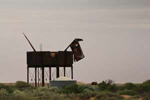
Old water towers make great pets, it seems

Old water towers make great pets, it seems


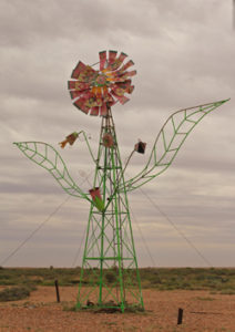
Flower power in the desert

Flower power in the desert

Man-made curiosities were almost outdone by the natural ones. Far below the sand and red earth is the Great Artesian Basin – a massive underground natural water supply and system. Every now and then along the Oodnadatta Track the underground comes overground.

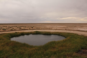
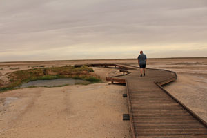
The Wabma Kadarbu Mound Springs are an oasis of softly bubbling calm literally in the middle of nowhere.

The Wabma Kadarbu Mound Springs are a verdant oasis and spiritual place for Aborigines

The Wabma Kadarbu Mound Springs are a verdant oasis and spiritual place for Aborigines


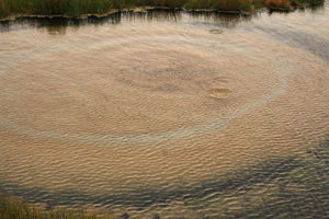
The Spring has been bubbling for milenia

The Spring has been bubbling for millennia


The spring is a few kilometres off the road and a totally unexpected patch of green and gold

The spring is a few kilometres off the road and a totally unexpected patch of green and gold

They are part of a string of springs through the region that were used by Aborigines for generations. More recently the easy access to water was the rationale for running the iconic Ghan railway line and overland telegraph through the region.

The Ghan powered the development of South Australia

The Ghan powered the development of South Australia

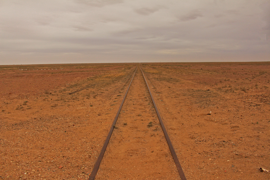
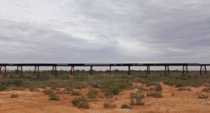
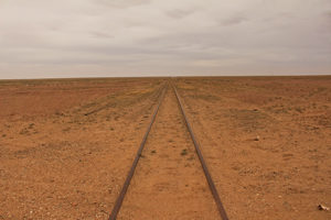
 The old Ghan line is long gone, but its ghost remains all along the track.

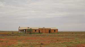
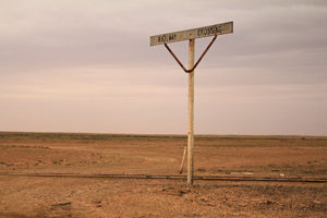
One of many old railway sidings now sinking into the outback desert

One of many old railway sidings now sinking into the outback desert

Long Ghan

Long Ghan


Ghosts of the great Ghan railway line can be found all along the Track

Ghosts of the great Ghan railway line can be found all along the Track


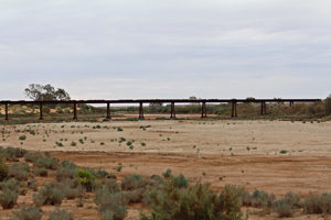
It's a long time since this crossing needed a second look

It’s a long time since this crossing needed a second look


Sometimes the good times roll again. One of siding shed is now famous for its annual outback new year’s even ball, but for most of the year the sands are slowly taking back the land.

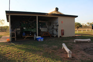
It doesn't look much like a ballroom venue

It doesn’t look much like a ballroom venue

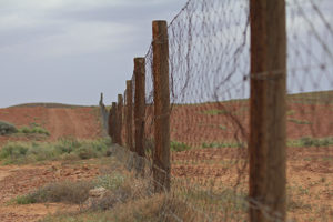
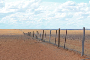
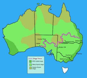
One man-made structure that is still maintained through the desert is the Dog Fence. The Dog Fence is the longest fence in the world. This humble stretch of wood and wire first built in the 1880’s is one of the longest structures in the world. Designed to keep dingoes away from sheep stock, it runs a mind-boggling 5,614km from the east to the south of Australia. And that is a couple of thousand kilometers shorter than it used to be!

The Dog Fence

The Dog Fence

Hundreds of men live along the fence, working in shifts and sleeping in small huts complete with satellite TV and shortwave radios to keep the barrier intact.

Our Oodnadatta journey ended just over half way up the track. We spent five days at William Creek, flying over Lake Eyre and helping out at the local pub. From there we turned off the Track and took the shorter Coober Pedy Track to the opal-mining town of of the same name.  The Living Fire is the fascinating story of that strange mining town. We fully intend to return and finish the last stretch one day.
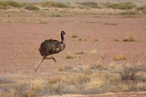
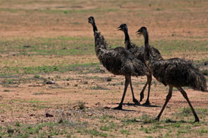
We’ve seen emus, roos and critters galore.
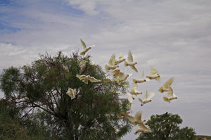
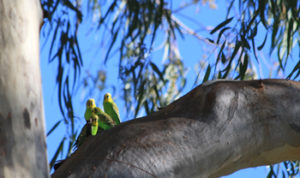
A flock of cockatoos bursts out of the trees at a waterhole

A flock of cockatoos bursts out of the trees at a waterhole


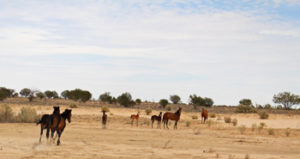
Wild horses - brumbies - in the desert

Wild horses – brumbies – in the desert


They may not be able to fly, but they sure can move

They may not be able to fly, but they sure can move


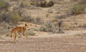
A young dingo in search of a good meal by the look of him

A young dingo in search of a good meal by the look of him

We have watched eagles soar on the endless thermals across a huge sky. We have battled lashing rain, all-enveloping, choking dust storms, energy-sapping heat and many, many flies.

About the only thing we saw on the whole journey and once he passed we couldn't see very much at all

About the only thing we saw on the whole journey and once he passed we couldn’t see very much at all

We rarely saw another human soul until we get close to a town and even then they are few and far between. But it is those hardy men and women from generations past, and the tough old buggers that still call the outback home who have made our recent journeys across the old stock tracks possible and so memorable.


post

The Big Detour

We were on our way to Lake Eyre. We weren’t even planning to go there, but just a six word message started  a 3,000km detour. The joy of unplanned vagabonding!

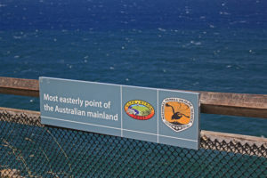
Our journey began right on the edge – as far from the red centre as we could get – on the most easterly point Australia at Byron Bay lighthouse.

First compass point down, three more to go

First compass point down, three more to go

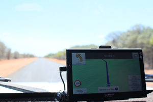
We were heading north to Cape York. But one text message from Geoff’s brother, Chris, to say “there is water in Lake Eyre” – an extremely rare occurrence – and we turned left and west – direction, the aptly named Adventure Way and a 2,500km detour from the original plan.

Adventure all the way

Adventure all the way

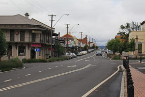
One of our first stops was an unassuming high street with a big claim to fame:

Tenterfield - the town that launched a nation

Tenterfield – the town that launched a nation

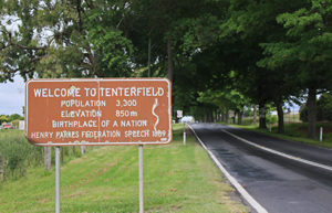
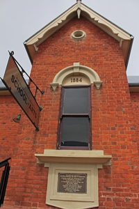
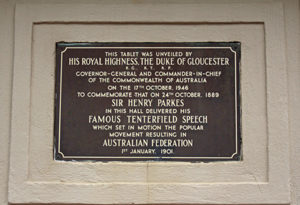
Tenterfield is credited as being the place where the Australian nation was born, following a fiery speech by Henry Parkes, a local politician strongly advocating unity of the colonies.

Welcome to the birth of Australia

Welcome to the birth of Australia


Where it all began - the hall where the federation speech was made

Where it all began – the hall where the federation speech was made


Remembering the start of it all

Remembering the start of it all

Such was the persuasiveness of his argument that is sparked the movement which produced the federation just over a decade later.

After Tenterfield there was not so much fire, but water. And it wasn’t long before we were an integral part of nature’s story.

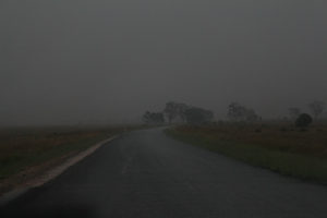
There's a reason there is water flowing into the Lake

There’s a reason there is water flowing into the Lake


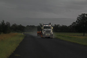
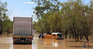
Road trains stop for nothing - even the rain

Road trains stop for nothing – even the rain


Our hubs floweth over

Our hubs floweth over

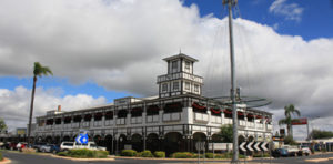
Torrential rain at Goondiwindi meant camping was cancelled in favour of a nice dry room at the splendid Victoria Hotel and although we left in bright sunshine the boggy roadsides told a different story.

The imposing Victoria Hotel was a grand sanctuary

The imposing Victoria Hotel was a grand sanctuary


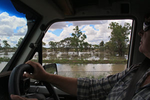
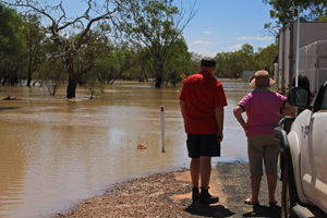
Even though it was high summer, the flood waters were right up to the road

Even though it was high summer, the flood waters were right up to the road

And many people thought we were crazy to do the trip in high summer. The signs were everywhere

You can check out any time you like, but you can never leave

You can check out any time you like, but you can never leave

But so was the welcome.

Everyone's a joker

Everyone’s a joker

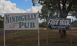
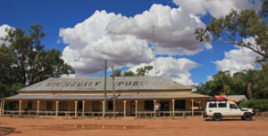
Nindigully Pub is a classic outback institution, miles from anywhere and also closed when we got there. But they opened up and offered a welcome cold beer when we pulled up.

The Nindigully pub - an outback institution

The Nindigully pub – an outback institution

They also had all the gossip despite their remote location – something we found repeated at every stop!

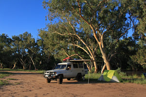
At Bollon the one-street town provides a beautiful free campsite alongside the river.

Free camping by the creek at Bollon

Free camping by the creek at Bollon


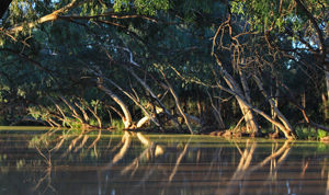
The lovely evening light on the creek at Bollon

The lovely evening light on the creek at Bollon


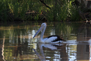
Apparently pelicans only appear when the water is set to stay

Apparently pelicans only appear when the water is set to stay


Cheery neighhbours in Bollon

Cheery neighbours in Bollon

When we arrived the locals had pulled up their chairs to watch the waters as they lapped at the sides of the road. We met Lonnie, the local policeman, general store-owner, gas station manager, camp oven cooking expert and world champion sheep shearer.

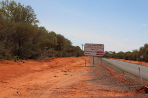
Next stop Cunnamulla, where we were told that the road ahead at Eulo was flooded and we couldn’t get through.

Well, there goes Plan A

Well, there goes Plan A

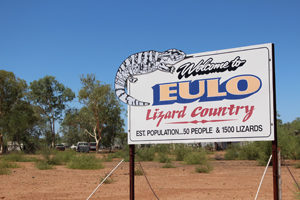
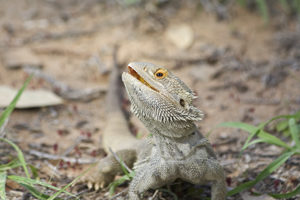
Eulo normally prides itself on the fact that the 50 residents share the town with 1500 lizards, but on that day it had a different claim to fame.

A proud boast that might not appeal to everyone

A proud boast that might not appeal to everyone

It wasn’t just a flooded road, but also a washed out bridge that stopped us and everyone else in their tracks.

Geoff and the locals contemplate the road less likely to be travelled now

Geoff and the locals contemplate the road less likely to be travelled now


The tide is high, but they're holding on

The tide is high, but they’re holding on


Here's one that Eulo missed

Here’s one that Eulo missed

We turned around and headed back to Cunnamulla only to discover the roadside show at Bollon had just got better and that road was now washed out too! Our only option for a bridge over the river was 300km north, and so began a 600km detour from our detour. We were starting to appreciate the trials of outback travel.

We were also beginning to really appreciate the generosity of outback communities. At Wyandra the town laid on a gorgeous free campsite, complete with fire pit, solar showers, a camp kitchen and a mob of kangaroos for company.

We vagabonds are very grateful to towns like this for facitilities like these

We vagabonds are very grateful to towns like this for facilities like these

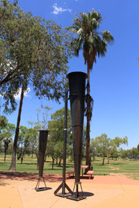
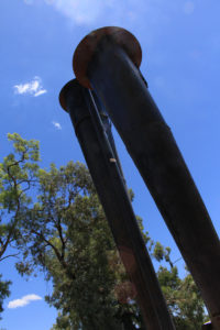
From Wyandra we continued our northern loop around the floods, through Charleville, where appropriately, the summer heat started to crank up again. An average day was topping 40 degrees. Charleville was most memorable to us for the marvelous Clement Wragge, the self-styled “rain-maker” who tried in vain to bring water during one of the worst droughts in the region.

The Vortex Canons in Charleville

The Vortex Canons in Charleville


The Vortex Canons are still not showing any sign of rain

The Vortex Canons are still not showing any sign of rain

His fantastic Stiger Vortex rain canons designed to fire gases into the atmosphere that create clouds and therefore rain. The guns failed and the drought continued for many more months. We could have done with a few canon firings that day, as the mercury continued to rise. We stopped counting at 48.5degrees during the day and a balmy 37 degrees overnight, in a nylon tent!

Even the locals look a little frazzled by the heat

Even the locals look a little frazzled by the heat


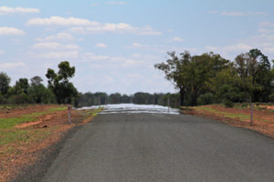
The heat shimmer on the road ahead

The heat shimmer on the road ahead

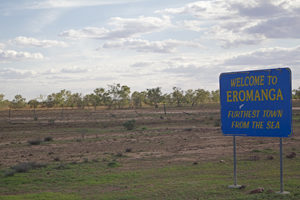
Next stop Eromanga – a town whose name has made it famous in Japan for meaning cartoon porn or erotic manga.

The least likely place to be a Japanese porn capital, but there are surprised everywhere

The least likely place to be a Japanese porn capital, but there are surprised everywhere

It’s dusty, deserted streets didn’t feel erotic, but there was something cartoonish about the Canadian campsite manager who was deeply suspicious of our intentions, claiming no one had passed through the area in a month.

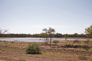
Eromanga maybe the most inland town, but it was looking pretty wet

Eromanga maybe the most inland town, but it was looking pretty wet

Onward we pressed heading toward Innamincka. It was not far from this isolated hamlet that two of Australia’s greatest failed adventurers, Burke and Wills met what some would say was their inevitable end. It is a story worthy reading and remarkable in it relentless hopeless endeavour. You can find our short version of it in The Long March to Failure.

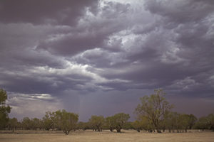
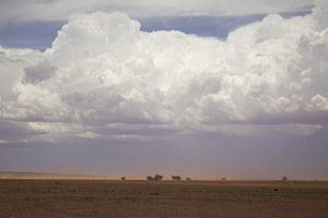
Spectacular but threatening skies

Spectacular but threatening skies

Full of stories of disaster we modern-day adventurers were painfully aware of the darken skies above us and set out for Innamincka – which boasts a pub, an hotel and that’s about it. It was also our starting point for the Strzelecki Track.

It was just a clear run into town - or so we thought

It was just a clear run into town – or so we thought

Burke and Wills may have planned badly, but even they couldn’t be blamed for the brutal nature of Australian outback in the summer. We soon came to appreciate some of their pain.


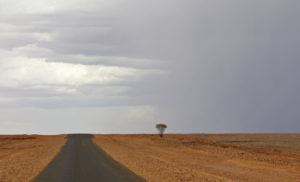
There may be trouble ahead

There may be trouble ahead

What started out as a hot, clear blue day soon became iron-dark and brooding.

Red sky in the middle of the day - outback warning

Red sky in the middle of the day – outback warning


The gathering storm

The gathering storm

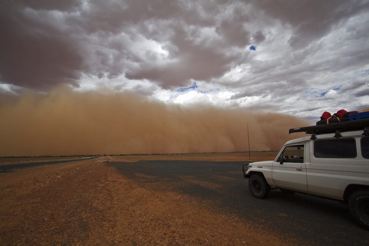
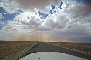
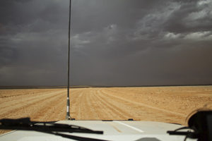
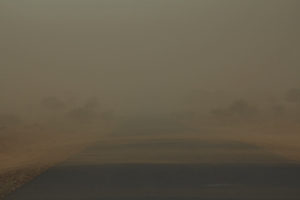
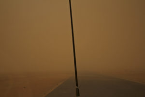
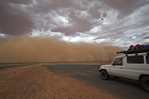
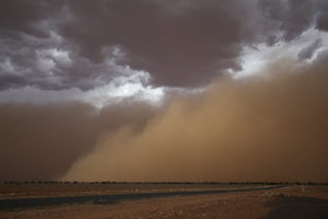
Before long the last bit of tarred road had given way to dirt and we were facing dueling storms – with half the sky blackened with thunder-clattering clouds and lightening bolts and the other a red-earth mass lifted off the ground more than a kilometer high and tens of kilometers wide.

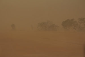
Alone on the road we could see nothing all around, but had no choice but to keep going. Bad as the dust storm was, getting stuck on a dirt road a long way from nowhere in a thunderstorm was worse. The mud-sucking qualities of an outback track are as legendary as the tracks themselves.

The pictures tell the story better than we can

The wind starts to pick up ahead of the storm

The wind starts to pick up ahead of the storm


The tar is rapidly becoming the dirt

The tar is rapidly becoming the dirt


The road is fast disappearing

The road is fast disappearing


What few landmarks we had were also fast disappearing

What few landmarks we had were also fast disappearing


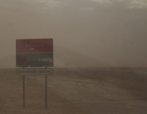
Completely enveloped in the red earth

Completely enveloped in the red earth

We finally punched through the dust storm and landed in Innamincka. Geoff poured kilos of dirt out of the air filter and the landlord poured cold beer.

More than a kilometre high and tens of kilometres wide

More than a kilometre high and tens of kilometres wide


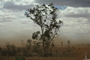
The line on the horizon are full-grown gum trees, dwarfed by the storm

The line on the horizon are full-grown gum trees, dwarfed by the storm


Thanks for the welcome South Australia

Thanks for the welcome South Australia

All of that and we still hadn’t even got to the Tracks. But next stop and next story – we will take you down two of the classic Australian outback tracks roadtrips.

post

Lake Eyre From The Air


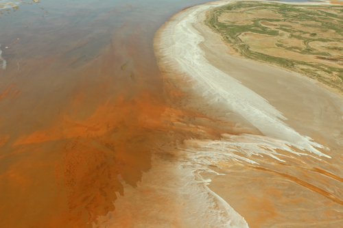
Lake Eyre is a massive contradiction. A lake where land speed records are broken. A salt flat with a sailing club. And it is a real sight to see.

It sits in the middle of a desert and is Australia’s lowest point at 15m below sea level. More than 140km long and 77km wide, most of the time it is a glittering, eye-scorching, shimmering white salt flat. It has filled only three times in the last 150 years.

But when it fills, Kati Thanda- Lake Eyre – to give it it’s full title – is the largest lake in Australia and becomes home to a mass of bird and marine life.

The Lake is miles from anywhere and yet, when the rains come, the yachties follow and members of one of the least met sailing clubs take to the water.

But it is a fleeting thing. The harsh outback environment ensures the waters never stay long. As the lake dries the fish die off from the increased salinity and the birds take to the air again.

We were very fortunate to have the chance to witness one of Australia’s great outback events.

We posted some pictures on our Facebook page awhile ago of Lake Eyre in flood – a rare occurrence that we just had to see. Just for our blog readers – here’s more loveliness.


post

The Living Fire

They’re called stones fallen from heaven, living fire, an anchor stone of hope. Some swear they made the owner invisible. We just call them opals and their story is magical.

The finest opals come from Australia. It’s not just a boast, it’s also a fact. Not only the finest, but also the most – 95% of all opals are eked out of this great continent.

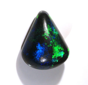
Black opals – which aren’t really …..

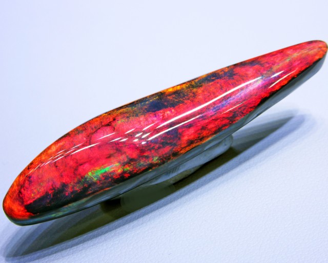
Black opals are never entirely black

Black opals are never entirely black


Some black opals even look blue

Some black opals even look blue

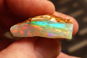
…..light opals, which are….

Light opals are most common in Coober Pedy

Light opals are most common in Coober Pedy

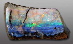
……. and boulder opals, which are a bit of both

Boulder opals are indeed part boulder and part opal

Boulder opals are indeed part boulder and part opal

– come in all shapes and sizes, but most importantly must have the fire that marks the gem.

Even the mining areas sound a little magical – Lightening Ridge, Mintabie, Andamooka, Quilpie and White Cliffs. Perhaps the biggest mining area is at Coober Pedy, in the very heart of the Australian outback.

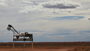
The Coober Pedy mining truck welcomes you to town

The Coober Pedy mining truck welcomes you to town

Coober Pedy is like nowhere else – literally an up-side-down world where the living make their homes and work underground and out of sight, while the cemetery is up-top and in the open!

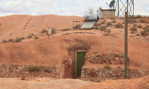
Home, sweet dome. The front door, tucked into the hillside

Home, sweet dome. The front door, tucked into the hillside


The house under the hill - one of many

The house under the hill – one of many


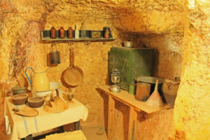
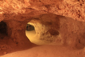
The majority of residents live underground in hillside dugouts

The majority of residents live underground in hillside dugouts


A dugout home

A dugout home


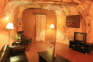
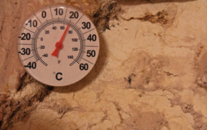
The temperature remains constant below ground

The temperature remains constant below ground


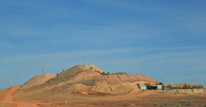
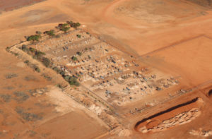
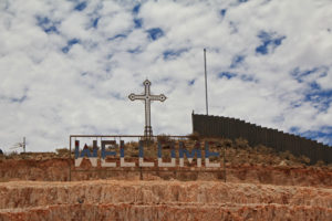
The Coober Pedy cemetery on a ridge above the town

The Coober Pedy cemetery on a ridge above the town

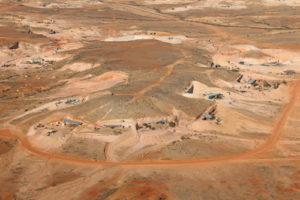
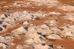
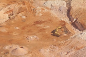
Flying over the town also gives a bird’s-eye view of the strange formations made from individual mine shafts. It’s claimed there are up to four million shafts in and around the town, giving it more of a Martian landscape.

A tiny part of Coober Pedy's moonscape of mine shafts

A tiny part of Coober Pedy’s moonscape of mine shafts

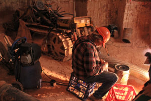
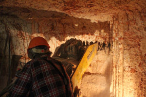
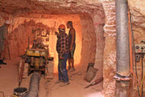
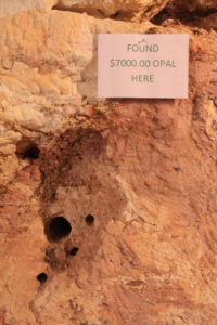
A millionaire in Coober Pedy (and they claim there are quite a few) looks the same as every other dust-coated, jeans and plaid-wearing worker; some have struck lucky in just a few feet of fine dirt, others have toiled for decades and never found a chip of colour. They say it is addictive. This miner told us he had already made a million by the turn of the 1980’s. In 2016 he was still down in the dirt.

A lifetime underground, hunting for the precious gems

A lifetime underground, hunting for the precious gems


Keen eyes endlessly watch for the glint of a gem

Keen eyes endlessly watch for the glint of a gem


It's not a hi-tech operation

It’s not a hi-tech operation


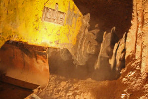
Spinning teeth eat into the mine wall

Spinning teeth eat into the mine wall

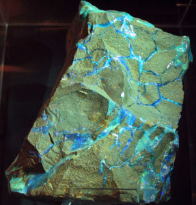
For all their value, opals started life as nothing more than trickles of silica running through cracks in the earth. Thanks to the inimitable creativity of Mother Earth, what gets chipped out the other side, millennia later is, if you are lucky, a milky stone of fire.

Trickling temptation - this is what the miners yearn for

Trickling temptation – this is what the miners yearn for

The stones have been lauded throughout time. Cleopatra was a big fan as were many royals and dignitaries. Roman women prized them above all other stones and the generals often carried opal-tipped staves into battle for luck. The not-so-lucky Marie Antoinette owned one called the Forest Fire. Opals were responsible for founding of London’s famous Hatton Gardens jewellery quarter after Sir Christopher Hatton presented the virgin Queen Elizabeth with a fine set of gems and in return she booted the bishops out of the Palace at Ely and presented Sir Chris with a fine place to live and work. The palace grounds became Hatton Gardens. A much more recent Elizabeth – Taylor – was also an avid collector, as were Andy Warhol and Elvis Presley.

It was originally thought that the gems were only found in the Carpathian Mountains in Europe, in a location so secret that the miners would employ complex subterfuge to remain undiscovered. Opals were also found in Mexico and Peru, feeding the ancient Mayan and Inca desires. Imagine the surprise and delight of opal lovers and miners when the gem they thought only available in a few limited and secret places were found half a planet away in Australia. 

Tulle Woolaston is credited as the first large scale trader. It is fitting that Australian opals were first introduced into Europe by Woolaston at Hatton Gardens – the place where is all began centuries earlier.

The opal rush began in earnest in 1889. Originally Coober Pedy the area was known as Umoona by the Aboriginals who lived there. After the mining boom began they renamed it Kupaku Piti, which translates to ‘white man’s hole’.

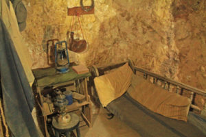
A basic miners dugout

A basic miners dugout

Early miners would often sleep in their claim to stop others from stealing their stones

Early miners would often sleep in their claim to stop others from stealing their stones

To look at the mine-fields now you could be forgiven for thinking not much has changed.

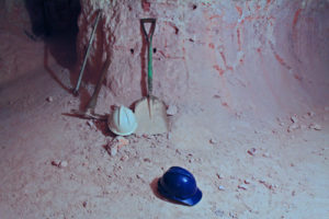
The tools of the trade haven't changed much

The tools of the trade haven’t changed much

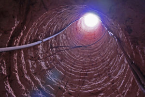
Unlike other mineral extraction, opal mining was and still is mainly a family business. Prospectors peg out a fifty metre square and drop 1.5m exploratory shafts.

Exploratory shafts are just 1.5metres wide

Exploratory shafts are just 1.5metres wide

Then the lateral tunnelling begins.

The tunnels goes for miles under the town and surrounding area

The tunnels goes for miles under the town and surrounding area


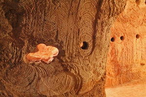
Artistic scars from the mining machines make for great wall art

Artistic scars from the mining machines make for great wall art

In 1972 mining was banned underneath the town itself, because of fears that it would simply fall in on itself. There was no detail of who was digging where, and most weren’t just digging, they were dynamiting too. It was the wild west of unregistered and unregulated mining just below the schools, shops and roads and right next to the dug out underground homes. The story is often told of the miner who blew out the lounge room of a neighbour chasing a promising seam.  One look from above and the endless miles of mine shafts shows just how real their concerns were.


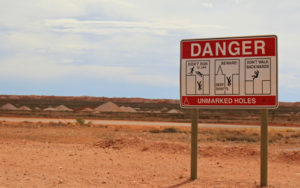
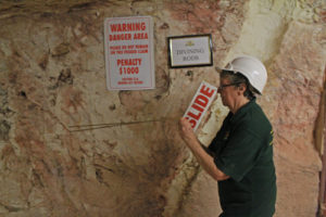
The many dangers of strolling around Coober Pedy

The many dangers of strolling around Coober Pedy


The earth moving from above

The earth moving from above


They say there are four million mine shafts around Coober Pedy

They say there are four million mine shafts around Coober Pedy

Exceptions are made for tunneling to make an underground home. It’s claimed that one Coober Pedy bachelor miner has had to dig out 20 bedrooms under the town, “to accommodate his huge extended family who occasionally visit”

And it seems that all the rules, all the bets and all the courtesy goes straight down the hole if you hit the right seam.

The mines promise much

The mines promise much

Coober Pedy is a town of secrets. No one trusts anyone and no one tells anyone anything. Miners are followed through the night to see if they have found a promising dig. Fortunes maybe won or lost, but all go on under the cover of the underground.

The promise of riches and beautiful gems has also brought hopeful families from all over the world. There are around 3,500 people living permanently in Coober Pedy, with 45 different nationalities.

Welcome to the underworld

Welcome to the underworld


The underground Serbian Church is one of many different denominations

The underground Serbian Church is one of many different denominations

Some look for divine inspiration, others have divining aspirations, thought it was hard to be convinced that it really worked.

Divining opals - not a very productive process

Divining opals – not a very productive process

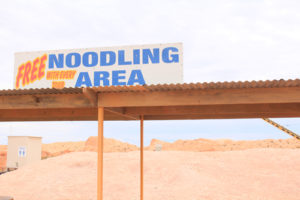
And if you can’t afford to dig, you can still feed your addiction, with a bit of noodling on the side – the terms of digging through the spoil heaps, or tailings, in search of a missed moment.  And yes, there are stories of people finding hugely valuable gems in a pile of dirt, of course there are!

Free noodling

Free noodling


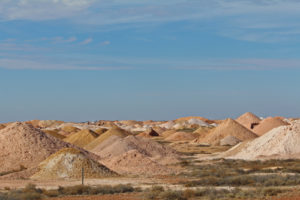
The tailings from countless mine shafts just might hold that lost stone

The tailings from countless mine shafts just might hold that lost stone

Coober Pedy is a curious place, full of mystery and intrigue, where the hopes of many nations come together. Beyond its boundaries is the vast outback, and it also has stories of magic and mystery to share.

The Moon Plain has featured in numerous apocalyptic movies, including Mad Max. Named for its endless empty scape, it is also an important place in Aboriginal stories and Dreamtime.

The desolate Moon Plains

The desolate Moon Plains

The black shadow of a soft cloud is all that breaks the view

The black shadow of a soft cloud is all that breaks the view

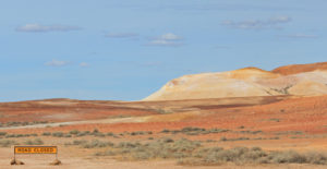
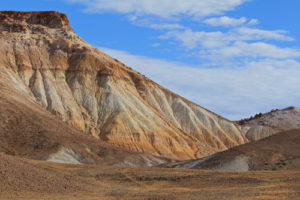
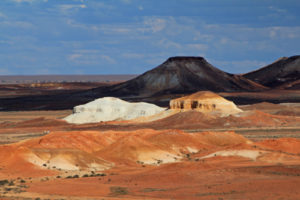
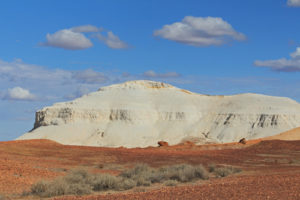
The Breakaways are a series of spectacular rock formations rising out of the Plain in distinct and distinctive colours. This is considered an important place of learning for young Aboriginal men.

One way only to the Breakaways

One way only to the Breakaways


The imposing mounds are considered sacred by the Aborigines

The imposing mounds are considered sacred by the Aborigines


The Breakaways cast in shadow

The Breakaways cast in shadow


The shapes and colours all tell a story

The shapes and colours all tell a story

While the two prominent formations are known as salt and pepper or the castle locally, the Aboriginal story tells of two puppies – one white and one yellow, sitting down near their owner the “man” in the shadow behind them.

The rich colours of the Breakaways glow in the late afternoon sun

The rich colours of the Breakaways glow in the late afternoon sun

You can clearly see why the Breakaways is also the main source of red ochre (tudu), used in Aboriginal dressing up ceremonies, as well as the source of other ochre colours.

The outback surrounding Coober Pedy holds millennia of history. From ancient stories, to gems as old as the land itself. It also is part of more modern record-breaking history.

Part of the Dog Fence

Part of the Dog Fence

“A fence”, we hear you say, “it’s a fence”. It’s not just a fence. The Dog Fence is the longest fence in the world. This humble stretch of wood and wire built in the 1880’s is one of the longest structures in the world. Designed to keep dingoes away from sheep stock, it runs a mind-boggling 5,614km from the east to the south of Australia.

The Dog Fence stretches across the continent

The Dog Fence stretches across the continent

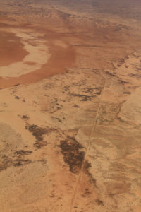
Hundreds of men live along the fence, working in shifts and sleeping in small huts complete with satellite TV and shortwave radios to keep the barrier intact.

You can see the Dog Fence running through the middle of the frame

You can see the Dog Fence running through the middle of the frame

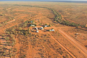
But if size does matter to you, then Anna Creek is for you. It is the world’s biggest property, spread over six million acres, or 24,000km2. If it were a country it would be 150th on the big list – greater than 89 others.

Anna Creek - the largest cattle station in the world, makes the Dog Fence look like a row of toothpicks

Anna Creek – the largest cattle station in the world, makes the Dog Fence look like a row of toothpicks


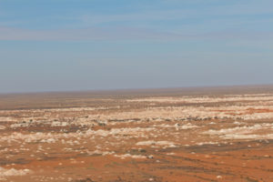
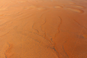
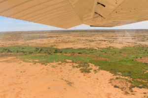
The vastness of the desert

The vastness of the desert


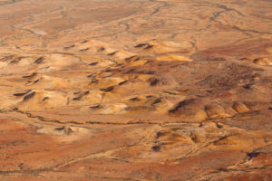
The desertscape is far from flat

The desertscape is far from flat


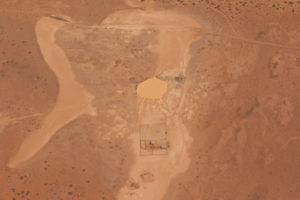
A mustering station and dam in the middle of the outback

A mustering station and dam in the middle of the outback


Parts of the desert are as green as a bowling lawn from the recent rains

Parts of the desert are as green as a bowling lawn from the recent rains


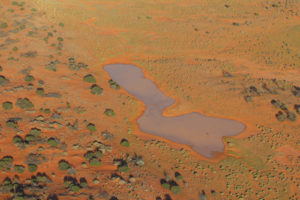
Just for scale - the green blobs are full-sized trees

Just for scale – the green blobs are full-sized trees


Far from being deserted – the Australian outback is full of life and stories. You could say it is both an ancient and modern, priceless gem.