The Gibb River Road is one of the classic Australian outback routes. Along its 700km length are crocodile-infested waters, stunning swim holes and spectacular scenery. Come, travel the road with us.
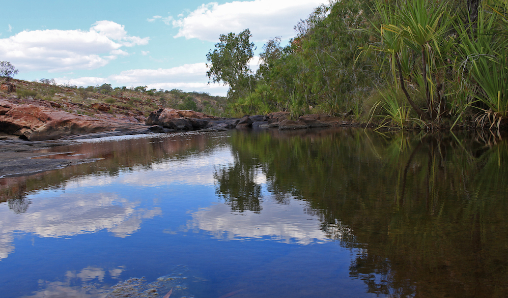

The Gibb River Road is one of the classic Australian outback routes. Along its 700km length are crocodile-infested waters, stunning swim holes and spectacular scenery. Come, travel the road with us.
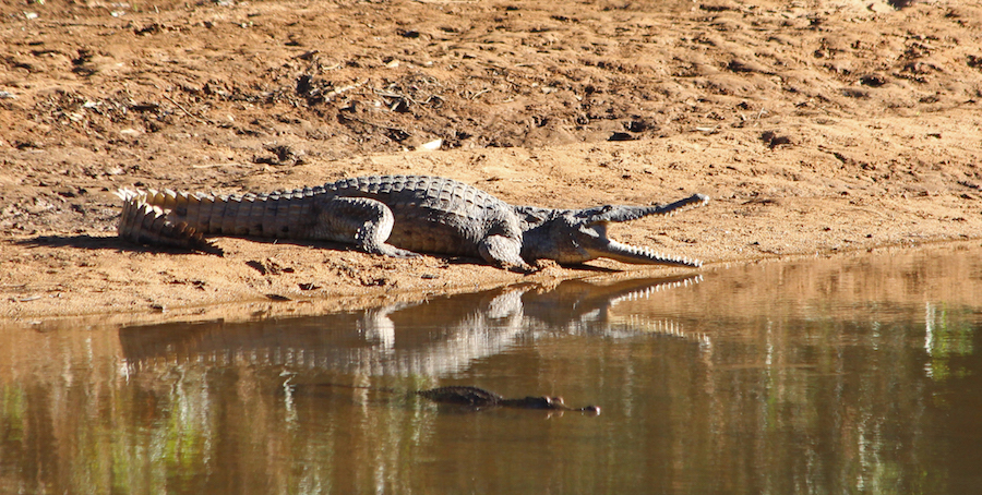
Stunning scenery, billions of bats, cruising crocodiles, fantastic hikes and the chance to splash about in puddles in a dark tunnel! Every turn brings us more magic in outback Australia.
The Fairfield Leopold Downs Road is an outback track which connects Halls Creek – the end point of our Tanami Track trek – with Derby – the start point of the Gibb River Road. Along its relatively short length are two spectacular stop-offs.
Tunnel Creek is the oldest tunnel system in Australia and it is exactly what it says on the tin – a creek running through a tunnel. Half way along there is a roof cave-in and a colony of sleepy bats. In between are small lakes and pools, so it was time to go splashing and clambering – just because we could.
Windjana Gorge, further up the Fairfield Leopold Downs road, is what remains of a coral reef from the inland sea which flooded the area more than 350million years ago. What looks like a rock face is in fact an ancient reef.
Much of the river bed was dry, but not all of it and there was just enough water for our first encounter with “freshies” – the rather cheery name given to freshwater crocodiles.
They were more interested in sleeping than eating, which was good for us, but they still kept an unblinking eye on an easy dinner.
The trees along the Gorge are creaking, squeaking and reeking of fruit bats.
There were tens of thousands of them and barely visible below the trees, who’s branches literally quivered and bent with the weight, was a wait of a different kind.
It wasn’t just crocs and bats though. We spotted some delightful birdlife too.
Both were fabulous walks through more lovely and ancient nature in West Australia and we have included additional images in the slideshow.
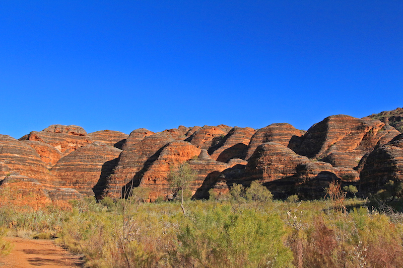
The Bungle Bungles are some of the most beautiful, striking natural formations in the world. Their weird and wonderful shapes are only outshone by their glowing colours and irresistible stripiness!
The cone karsts of the Bungle Bungles or Purnululu National Park, to give it its Aboriginal name, are quartz sand-stone formations that have been eroded over 20 millions years to form these beautiful domes, canyons and gorges. Incredibly it was only in 1987 that they become known to more than the local Aboriginal communities and a few passing stockmen and only 20 years ago they were declared a World Heritage site.
How could you not shout about this?
There are a number of different areas to explore.
Cathedral Gorge is famous for its majestic permanent waterhole and acoustics.
Homestead Valley has only been opened up in the last couple of years and draws you in to its shaded palm-lined canyon.
Echidna Chasm has to be the best. An ever-narrowing boulder-strewn scramble through a slice of the ancient rocks, that changes light and character as the sun passes over the narrow skylights about.
Words can’t really describe the best of the Bungle Bungles, so there are extra images in the slideshow for you to enjoy.
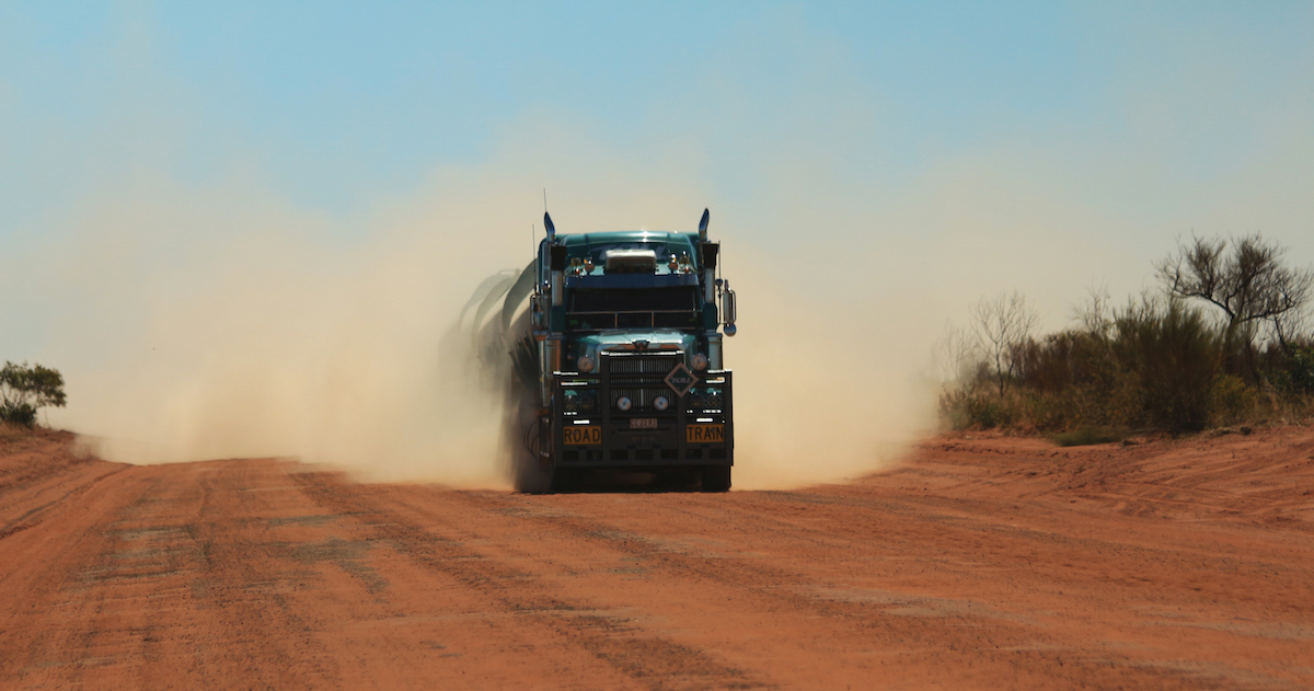
It’s a 1000km of dirt, corrugations, gold mines and road trains. The Tanami Track is also the fastest way from the Centre to the west. It took us three days.
The first two hundred km are tarred, but after that it is nothing but red dirt as far as the eye can see.
There is one roadhouse and one aboriginal community along the entire length of the Track. There used to be more, but as with many other outback areas – the life was just too hard for too little and stations were abandoned.
We spent our first night looking out across the salt pan of Lake Lewis and the last of the West MacDonald ranges in the distance and enjoyed a spectacular moonrise.
The morning was pretty special too!
We liked it so much that we are willing to share with other travellers, so entered it on the Wiki Camps app, which is the camping bible in Australia.
Day two and the corrugations on the dirt road were pretty bad. The tyres kick up ruts in the dirt, which become deeper and more cut up the greater the traffic and the faster the speeds. Sometimes our speed was down to 20km just to minimise the shakes.
The photos don’t do justice to the road, so here’s a short video to give you an idea of what it feels like. This isn’t the worst part, I couldn’t hold the phone for that bit!
But there is much more to the desert than ruts and dust. And there’s always time for a cup of tea, regardless of the state of the road
Our second night was even more glorious than the first. On a full moon we found the only raised section of desert for miles. With 360-degree views we watched the desert colours change with the rising and setting sun and moon.
About 5km away was The Granites Gold Mine.
Home to the world’s largest road train. For the nerdy among you, it is so big it can pull 400tonnes of gear, with a 650HP prime mover at the front and a remote controlled 400hp engine trailer in the middle. We didn’t see the truck, although we heard many ploughing up and down nearby tracks, but we did manage to steal their wifi signal and took great delight in phoning home from the middle of the desert!
Parts of the Tanami Track feel a little samey in terms of view, but there are also endless surprises and wonderful places to pull up.
Day two and we were on the fuzzy end of another road train. One of the things that is good to avoid on a dirt road is getting stuck behind another vehicle – especially a large lorry.
This is what it is like trying to get passed one. Turn up the volume to hear Geoff and the driver’s discussion and some under-the-breath swearing from me!
The driver was our eyes ahead, when his clouds of dust were making us blind. It was a little hairy, but you put your faith in the guy who can see and go for it!
Towards the end of the Tanami Track is Wolfe Creek – the world’s second largest meteorite crater.
A mere 300,000 years ago a 20,000 ton meteorite, travelling at 15km per second, or 54,000km per hour (considerably faster that we managed on that road), slammed into the earth and exploded a crater 140m deep and 850m wide. Today the crater has been filled with dust and only sits 11m deep – but it is still an impressive and mind-boggling sight to imagine what happened here.
Wolfe Creek is also the scene of a slasher movie where hapless road trippers are tricked into a mass murderer’s house. The fake bloodied hand on the sign for the crater was a little reminder of the movie.
Thankfully, we have a mechanic on board and we were more awed by what a meteor could do, than a Hollywood manic.
Although I did think this dude floating in the air near our tent was pretty scary.
The Tanami Track is interstate – crossing from Northern Territory to West Australia.
The unassuming sign is a major landmark for us, as we now venture into states unknown. From now on everything in this ancient part of the continent is new to us both and already we have seen some extraordinary places.
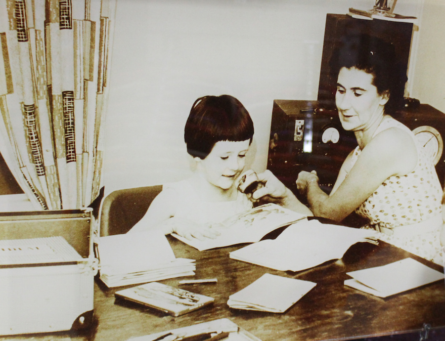
Necessity is the mother of invention and when the nearest school or hospital can be days away by rough dirt track, extraordinary people get busy creating amazing ways to manage.
Alice Springs, in the Northern Territory, is both central and remote. A place explorers thought couldn’t exist until a gap was found through the hills and mountain that encircle it, it has become the epicentre of two of Australia’s greatest, most widespread and essential community services – The Royal Flying Doctors and the School of the Air.
A missionary, John Flynn, first conceived the idea of the now essential medical service and the first flight in 1928 was the start of so much more than he could have imagined.
The first pilot – Arthur Affleck, had no radio, no navigational aides and only rudimentary road maps. He navigated by fences, river beds and telegraph poles.
The Royal Flying Doctors Service now has 63 planes spread all across Australia, providing emergency care and weekly clinics to some of the most remote places you can imagine across vast distances.
We have not passed through an outback station or pub that didn’t have a fundraising tin for the RFDS – because they know it is their lifeline. This small section of map indicates the landing strips for the planes. Red and blue are different types of dirt track. Yellow is bitumen – the stuff the rest of us are used to landing on.
The facts and stats for this service are quite incredible
John Flynn’s idea could not have taken off without Alfred Traeger. He invented a portable, pedal-powered two-way radio that allowed more effective communication over 500km. It was the breakthrough the service needed to cover the whole country.
Traeger’s invention was instrumental in creating another of Alice Spring’s great claims to fame – the School of the Air.
Boasting the largest classroom in the world, the School of the Air has been transmitting classes to far-flung outback children since 1951. Starting over the radio and now in full-technicolour over the internet.
There are 150 children at various levels up to age 14, and spread across more than a million square kilometres.
Sadly we don’t have the pictures to do justice to this story. The school was off on mid term break when we visited, but just imagine for a moment how important it must be to remote families across this vast continent to have access to such a service. The children’s artwork gives a hint of the very different lives they lead and the need for their teachers to understand them.
Alice Springs was the place that didn’t exist. For many years explorers couldn’t find a way through the MacDonald ranges and today the town is still surrounded by vast nature.
It is perhaps no surprise that the mothers and fathers of invention created such great community services in a place that was so far from anywhere. Alice Springs was central to outback development and many pioneers were born or passed through here. We take our inspiration and determination from them, though Sara might skip the bonnets!
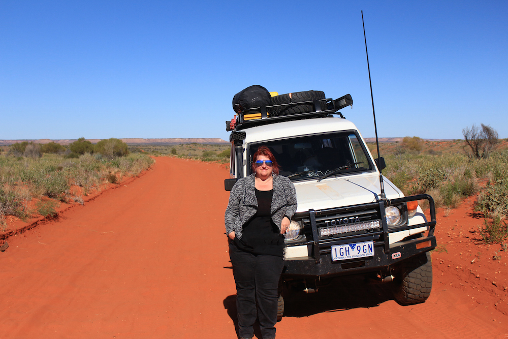
There’s the so-called Red Centre of Australia – which includes Uluru. And then there’s the Dead Centre. We shot down the aptly-named Gun Barrel Highway to pay it a visit.
If you look at a map you can seen why the Gun Barrel was so named. Len Beadell – surveyor and road builder extraordinaire – wanted it to be as straight as the very same.
Nice work Len!
Despite its appealing straightness, it is now a road less travelled.
We found a lovely example of another Australian classic along the way. Water-pumping windmills have been a lifeline for farmers across the country. The Southern Cross windmill was first built in 1876 and the steel-bladed water-bringers have been cranking through the outback since.
The windmills of the outback kept the water flowing and the people and cattle going.
Just a little bit of water is all it needs to keep the desert growing too, it seems. Far from being an empty wasteland, plants and flowers spring up at the sides of the track.
Of course water is great for flowers and cows, but not so great for 3 ton wagons like ours and we had to pick our way carefully.
We found some slightly bigger hazards too, but thankfully they were behind a fence.
Having travelled a short section of the Gun Barrel, we turned up onto the track leading to Lambert’s Centre – the geographical centre of Australia.We can only assume that visitors aren’t very welcome at the Centre – it took us more than a hour to travel 14km on one of the worst roads we have covered so far.
Bruce Lambert (of the Centre) was one of Australia’s most decorated surveyors and explorers, but ironically never made it to the landmark that bears his name. Perhaps if he had, he might have had something to say about the road.
Unlike Bruce – we set up camp for the night. Another compass point ticked off the list.
The road to the centre was not the best. The road from the centre didn’t get much better. We did as good travellers should and took advice from the locals.
Travellers: “Is the Old Ghan Track, (now called the Finke Desert Track) okay at the moment?”.
Man at Finke gas station who’s also just taken $90 off us for diesel: “For sure, it knocks two hours off the trip to Alice Springs. You can sit on 60-80kmph. Some people even do 100kmph”
It would take too long to go back to Finke to correct the gas station guy, but suffice to say he should probably get out more.
Never mind 80km per hour – it took us three hours to do 80km! The road is 247km long.
As well as the hideous corrugations in some sections, parts of the Finke Desert Road run directly over the top of the old Ghan Railway line. We had to be careful to avoid the original steel bolts that littered the route and would have taken out a tyre very quickly. The famous railway was a lifeline for outback communities when it was laid through the centre of Australia. Working parties lived on the line for months on end. But much of that history is lost in the desert now.
The new Ghan line still runs. Perhaps fittingly it was one of the first things we saw when we finally arrived in Alice Springs a mere six hours later.
You may be amused to hear that the Finke Desert Road is also the route for the Finke Desert Race. Apparently they can make it from Finke to Alice Springs in two hours, but then they are driving like this:
The race was a couple of weeks before our trip, so the road had been well chewed up by support crews and spectators. We ended up driving the race route, which had huge ruts, but because of the spacing and depth, it was more comfortable than the road.
So however long it took, we can now legitimately say we have driven the Finke Desert Race track!