
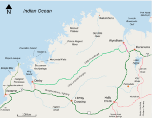
The Gibb River Road is one of the classic Australian outback routes. Along its 700km length are crocodile-infested waters, stunning swim holes and spectacular scenery. Come, travel the road with us.
From Derby in the west to Wyndham at the eastern end, the road was originally cut as a cattle route and there are still many cattle stations and homesteads scattered along its length, although many now trade in tourist fodder.
We travelled a short section of the road when we came up to Broome from Windjana Gorge and Tunnel Creek. After our sprint down to Ningaloo reef for a date with some whale sharks, we then began the serious business of the Gibb River Road route.
And so it begins – the start of the Gibb River Road
It’s called Queen Victoria’s Rock – I don’t know if she would be amused
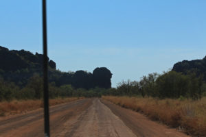
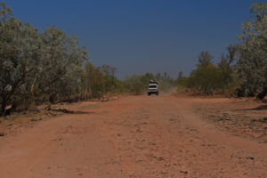
The road is almost impassable during the Wet. The ease of the drive in the Dry will often depend if you are arriving just before or just after the road grader has been through. The graders push a massive blade across the surface of the track , flattening out the corrugations that can be a teeth-rattling feature of the outback tracks.
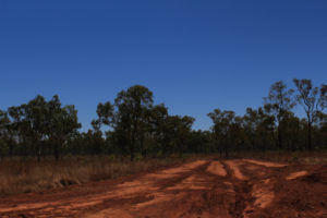
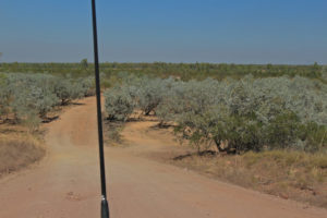
Rough red road
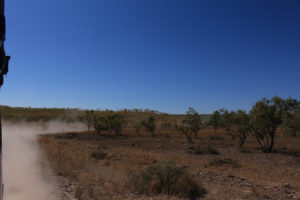
The dusty trail we left everywhere we went
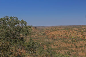
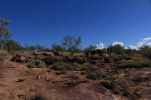
The views are vast
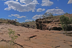
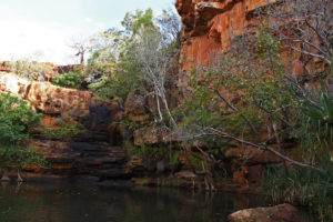
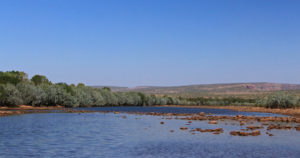
Out of Derby we headed for our first swim hole at Lennard Gorge, only to be stopped early in our tracks by a road closed sign.
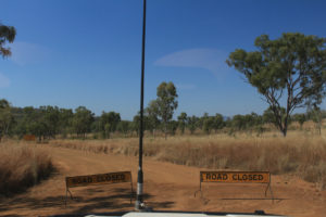
Our first attempt at a gorge was stopped because of a bushfire
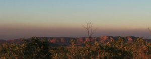
The setting sun and the bushfire haze
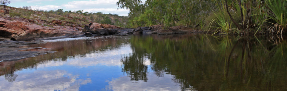
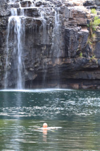
We pressed onwards toward one of the most famous of the gorges – Bell Gorge – and soon discovered why it had such a reputation. We camped at the aptly named Silent Grove and the next day set off for the gorge. The hike into Bell takes your along dry creek beds, scrambling over rocky terrain and clambering down into the gorge itself. Don’t imagine for a minute there are easy steps or shade from the beating sun. But the hike is part of the trip and the rewards are certainly worth the effort.
The top pools at Bell Gorge – there is still a climb down to get to the swimhole
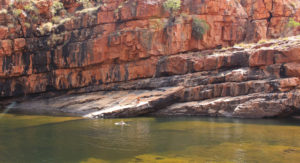
Swimming in Bell Gorge
Looking down into Bell Gorge
Hiking across the top of Bell Gorge
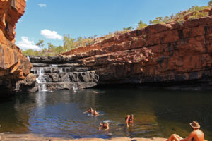
Bell Gorge is definitely worth the hike
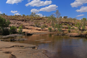
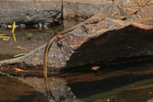
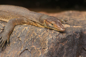
We camped overnight at a nearby stop and then headed off the next day, swinging by Adcock Gorge to take a dip with a friendly fresh water crocodile and shared the beautiful Galvans Gorge with a tree-hugging monitor lizard.
Hiking to one of the many swim holes – you earn your swim!
The mirrored waters of Garvan’s Gorge
The lovely swim hole at Garvan’s Gorge
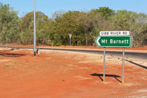
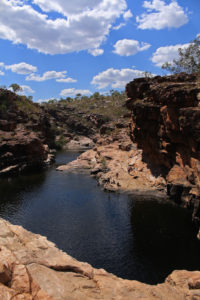
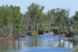
For many Manning Gorge is the best stop on the road. Driving off the main Gibb River Road at the Mount Barnett Roadhouse, and down a 7km track that went from dust to dirt and then to river crossing and back to dirt, we arrived at the campground for Manning Gorge. It seems a lot further than the distance on paper!
One of the river crossing heading into Manning Gorge
It’s a long drive in to Manning Gorge
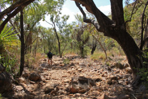
The following morning we packed up our water bottles and headed out for the trek to the Gorge. Although the treks are not hard, the heat, dust and hiking are not for everyone, especially when you have to haul in your own boat to cross the Manning River before you even start. But we loved it – and the leaky boat too!
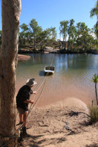
To get to Manning Gorge, first catch your punt
Hauling ourselves across the creek to start the hike to Manning Gorge
It’s a bit of a hike without much shade to get to Manning Gorge
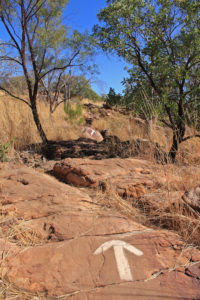
Low tech but effective directions to Manning Gorge
It’s a 5km walk to the Gorge, with some clambering and scrambling along the way and no shade, but the views are glorious and the gorge is, well, gorgeous!
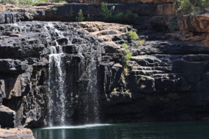
The water was still running at Manning Gorge
We spent the day lazing around in the pools. It was the only one of the gorges that still had water running, as that season’s wet had been a poor one and we were late in the dry season.
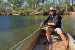
Geoff taking a swim at Manning Gorge
Keeping a cooling tail dipped in the water at Manning Gorge
What a beauty
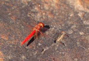
A delicate but bold dragonfly
Once you have hiked there and back you can still relax in the cool river by the campsite
We would love to come back when the waters are flowing more freely.
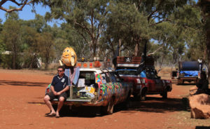
We left the next day – not a moment too soon, as a convoy of garish Variety Club cars came crashing through on a one-day Gibb River Road Bash.
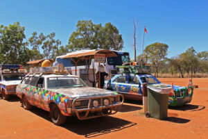
After a peaceful day at Manning gorge, the circus came to town
Get in the van
Typically, if you have time, there is another classic diversion off the main Gibb River Road, 600km up to Mitchell Falls. But the park rangers told us the road was a shocker and the falls were dry, so we continued on the main track to Barnett River Gorge.
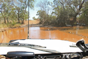
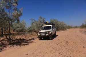
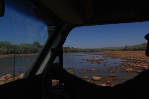
After five days on the road, we were preparing ourselves for what we thought would be the biggest challenge – two river crossings at the Durak and Pentecost rivers. Both are known habitats for salt-water crocs, so once you are in, you had better not get stuck!
The Durak River
The Pentecost River
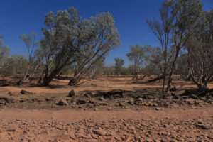
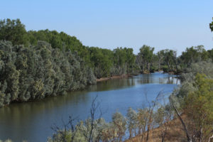
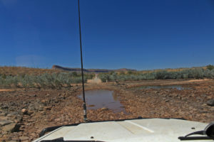
Our excitement sadly dried up as quickly as the river-beds we came to cross. Nature and the end of the dry season had conspired to leave us with barely a puddle to paddle through at the Durak. It is hard to imagine that where we parked the troopy is normally a raging river in the wet.
Sometimes the Durak River is impassable. Sometimes it’s just red dust
During the Wet this is the fast flowing Durak River
A bad Wet left the Durak River crossing just a dry creek bed
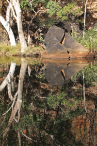
Further down river we found a good camping spot above the river and sat by the fire to listen to the sounds of the outback nightlife.
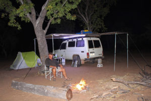
Relaxing by the fire on the edge of the Durak River
This part of the Durak was still flowing
The next day in the shadow of the massive Cockburn Range, the mighty Pentecost River looked more promising from a distance, but still barely got our rims wet when we got down into the river bed.
The Cockburn Ranges at the Pentecost River
From a distance we were daunted at the prospect of crossing the Pentecost River
Driving across the Pentecost River
Our dramatic Pentecost River crossing wasn’t quite as wet’n’wild as we had hoped
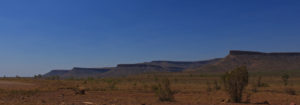
Our dust-clogged wagon finally hit the tar after six days and nearly 700km and we turned north toward Wyndham. As you approach Wyndham the spectacular Pentecost Ranges come into view with massive ramparts and scree slopes. Despite its surrounding grandeur and spectacular locations at the confluence of the “Big Five” – the King, Pentecost, Durack, Forrest and Ord Rivers – Wyndham is a town down on its luck, with many of the main industry shut down and little to replace it. Even at the height of colonisation of Australia, Wyndham seems to have failed to impress.
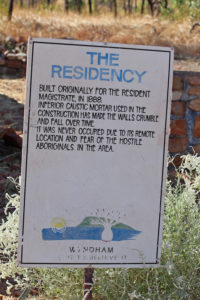
Not such determined settlers
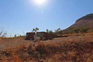
The remains of The Residency
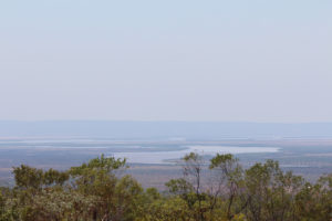
But it has one of the best campsites we have stayed in, the most fantastic sunset hilltop view of the Big Five confluence
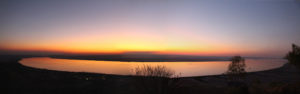
Panorama from the Five Rivers lookout at Wyndham
and the cutest rock wallabies you’ve ever seen.
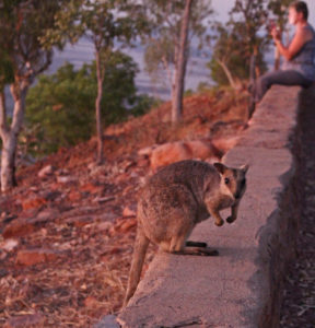
The little rock wallabies at the Wyndham lookout
From Wyndham we headed back south, stopping off at the vast Ord River Dam, which created Lake Argyle, Australia’s largest artificial lake.
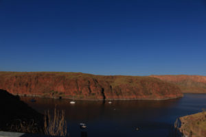
Lake Argyle and the Ord River Dam
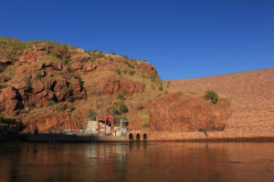
The Ord River hydro-electric plant
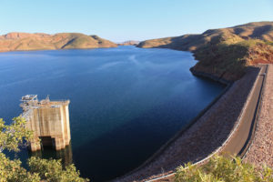
The massive Ord River dam
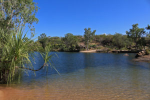
The slightly more manageable and entirely natural lake at Kununurra is where we pitched up to camp, in time to meet the unearthly Jabiru. Later than night we awoke in our tent to find the beady orange eyes of some fresh water crocodiles just a few metres from the zipper! Good job they’re friendly!
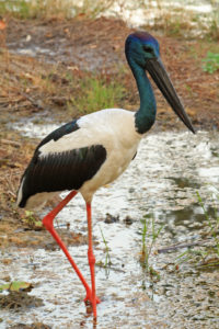
The magnificent metre-tall Jabiru
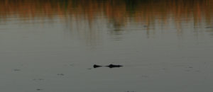
Our neighbours at Kununurra Lake
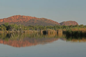
The view across the lake at Kununurra
The Gibb River Road was our last big trail on this part of our Australian adventure and we would love to do it again earlier in the season, when the waters are still running in the falls and the river crossings. But it was a great trip, which set us up beautifully for our next big adventure – getting married!


